- Home
- Attractions
- All Attractions
- ATTRACTIONS PROFILES
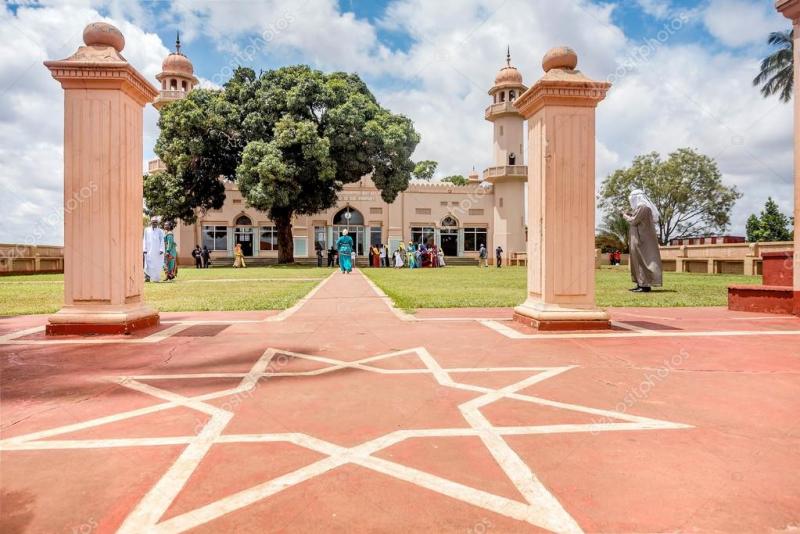
Kibuli Mosque
Kibuli Mosque is one of the biggest and oldest mosques in Uganda with a beautiful view over Kampala. For a small fee you can visit the mosque and the towers as well.
The history of the mosque and its administration is closely linked to the history of the city, and indeed, country.
The mosque’s history is closely linked to the history of Islam in the country. In 1844, Islam came to Uganda. Suuna II was Kabaka of the Buganda Kingdom from 1832 to 1856. He embraced Islam but there were some teachings which were at odds with Buganda practice and when his son, Mwanga II became Kabaka these were exacerbated. Over the course of the next generation, with the arrival of colonial powers the role of Kabaka was split from leadership of the Muslim community. Prince Nuhu Mbogo (meaning ‘buffalo’) was particularly strong so the British gave him the plot on the hill in Kibule thinking he would build his palace there. Instead, he built it in the valley and donated the land on the hill for a small mosque to be constructed. Later, Prince Mbogo’s son, Prince Badru Kakungulu donated a further 80 acres in order that additional institutions could be built.
In 1941, the Aga Kan visited and wanted to assist in building a mosque on the site. The cost was to be 250,000 UGX and in order to help facilitate fundraising the Aga Khan offered a ‘shilling for a shilling’ fund matching programme and as money was raised building began.
The mosque was completed in 1951 and opened for service that year. The current patron of the mosque is Prince Kassim Nakibinge Kakungulu, the grandson of Prince Mbogo. It has been visited by a number of dignataries including the Presidents of Iran, Sudan, Zambia and Tanzania, the current and all previous Kabakas and Presidents of Uganda, the King of Saudi Arabia, and the Aga Khan.
Kibuli Mosque sits atop Kibule Hill along with an associated nursery, primary and secondary schools, hospital and nursing school. It is easy to access from the centre by either car or public transport. See the map below.
When visiting make sure to bring your camera and climb the minaret which offers magnificent views of Kampala. Also, make sure to note the giant Mango tree directly in front of the mosque. It is far older than the mosque and was left as it is as a reference point to all historical pictures.
The mosque is open and welcomes visitors between times of prayer. The best times to visit are: 8am-12pm, 2-4pm, and 5-7pm. Other Source:UMBS
-
Mosque
-
Mosque
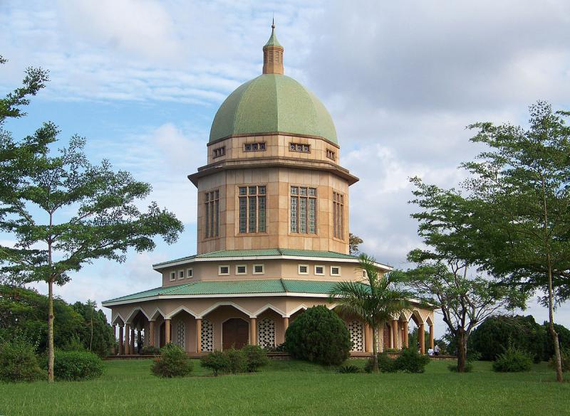
Bahai Temple
Visit the mother Temple of the Bahai faith in Africa. And just like the faith it represents, the Bahai temple is no ordinary house of worship. Sitting on 52 acres of land, the temple is a unique architectural master piece. Built between 1958 and 1961 on Kikaaya hill, three miles North of Kampala the building is 130ft. its dome is a 44ft in diameter. It is a nine sided structure which represents oneness and unity of the faiths biggest tenets.
It seats on a beautiful park like ground with lots of beautiful trees most of them fruit tree species plus flowers as well as a green-carpet like grass with clean clear gazetted paths leading to the dome. This park like environment attracts many people who sit on the grass and have a peaceful moment or hold picnics not forgetting couples in love who flock this place for quality time.
-
Temple
The Uganda Museum
The Uganda Museum is located in Kampala, Uganda. It displays and exhibits ethnological, natural-historical and traditional life collections of Uganda's cultural heritage. It was founded in 1908, after Governor George Wilson called for "all articles of interest" on Uganda to be procured. Among the collections in the Uganda Museum are playable musical instruments, hunting equipment, weaponry, archaeology and entomology.
The Uganda Museum is the oldest museum in East Africa; it was officially established by the British protectorate government in 1908 with ethnographic material. Its history goes back to 1902 when Governor George Wilson called for collection of objects of interest throughout the country to set up a museum. The museum started in a small Sikh temple at Fort Lugard on Old Kampala Hill. Between the 1920s and 1940s, archaeology and paleontological surveys and excavations were conducted by Church Hill, E. J. Wayland, Bishop J. Wilson, P. L. Shinnie, E. Lanning, and several others, who collected a significant number of artifacts to boost the museum.
The museum at Fort Lugard become too small to hold the specimens, and the museum was moved to the Margret Trowel School of Fine Art at Makerere University College in 1941. Later, funds were raised for a permanent home and the museum was moved to its current location on Kitante Hill in 1954. In 2008, the museum turned 100 years old.
-
Cultural Museum
-
Historical Museum
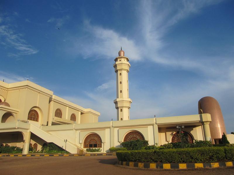
Uganda National Mosque
The Uganda National Mosque is a mosque located at Kampala Hill in the Old Kampala area of Kampala, Uganda. Completed in 2006, it seats up to 15,000 worshipers and can hold another 1,100 in the gallery, while the terrace will cater for another 3,500. Colonel Muammar Gaddafi of Libya commissioned the mosque as a gift to Uganda, and for the benefit of the Muslim population. Uganda has many mosques but this one is a skyscraper mosque.
The completed mosque was opened officially in June 2007 under the name Gaddafi National Mosque, and housed the head offices of the Uganda Muslim Supreme Council. It was renamed "Uganda National Mosque" in 2013 following the death of Colonel Gaddafi as the new Libyan administration was "reluctant to rehabilitate the mosque under the old name
-
Mosque
-
Mosque
-
Temple
.jpg)
Katonga Wildlife Reserve
Description and Management History
Katonga Wildlife Reserve with an area of 207 square kilometers was gazetted in 1964 as a game reserve, to serve as a corridor for migrating wildlife from Western Uganda to Tanzania and Sudan. It became a Wildlife Reserve in 1996 when the former Game Department and Uganda National Parks merged to form Uganda Wildlife Authority (UWA). Currently, the reserve is managed by UWA under the Kibale Conservation Area administration with a Warden In-Charge based at the Reserve Head Office at Kikorogoto.
Location and access
The 207sq.km Katonga Wildlife Reserve is a savannah grassland ecosystem located within Kyenjojo and Kamwenge Districts. The journey into the Reserve is a three-hour drive from Kampala to Kyegegwa Town Council. At Kyegegwa, detour southwards for 42 km following well visible signposts.
Fauna and Flora
Flora
The Reserve’s terrain is predominantly undulating in nature with distinct vegetation types. Vegetation includes grasslands, wooded grasslands, woodlands, riverine woodlands, swamp, riverine grasslands, papyrus. Most of the area is mixed savannah with acacia or woodland. However, large portions of the reserve are either permanent or seasonal wetlands. The reserve also contains various pockets of riverine and tropical forests. Its unique geographical location between forests, swamps and savannah vegetation gives the reserve a diverse ecosystem that favours the existence of a variety of animal species. The most dominant plant species include Sporobolus festivus and Chloris gayana. These species exist with associate species like Setaria species, Hyparrhenia species and occasional Panicum maximum. The Katonga wetland system is interlinked with the Nile system forming an important wetland system for human survival. The variety of different vegetation types, particularly the wetlands, provides a range of habitats, which enhances the faunal diversity of the reserve.
Wildlife
Katonga Wildlife Reserve has a viable Sitatunga population inhabiting the Katonga Wetland System. The reserve also habours high population of waterbucks. The population of Hippos and birds is also growing in addition to primates.
In the 1960s, the reserve was home to a variety of animals including the zebra, topi and eland, which are no longer seen in the reserve. Elephant, buffalo, waterbuck, bushbuck, reedbuck and sitatunga still occur in the reserve. Between 1971 and 1985, most of the wildlife was killed through commercial and subsistence poaching. The reserve was also heavily encroached by cultivators and cattle grazing. In 2014 however, all the encroachers in the park were evicted.
In 2015 60 Impalas and 5 Zebras were successfully translocated to the reserve in order to restock and boost animal populations for tourism. The population of impalas now stands at 300 individuals The current bird checklist is over 150 including species specific to wetlands, savannah and forests. Other mammals include Black and White Colobus Monkey, the River Otter, and Olive Baboon, Uganda Kob, Waterbuck, Leopard, Buffalo, reedbuck, bushbuck and duiker and chevrotain. The reserve is also home to various reptiles, amphibians and butterflies. The table below shows the 2004 animal population census results for the reserve.
-
Birding Site
-
Forest
-
National Reserve
-
Wildlife Conservancy
Bongoyo Marine Reserve
Bongoyo Marine Reserveis uninhabited Island, located 2.5km north of the country capital city, Dar es Salaam.It is the most frequently visited island of the Dar es Salaam Marine Reserves System (DMRS). The island lies close to the Msasani Peninsula is reachable by means boat ride, it takes only 30 minutes from the mainland.The point of departure for most visitors to the island is “the Slipway mall complex” on the western side of the Msasani Peninsula.
The underwater habitat range from shallow gently sloping coral reefs, sandy expnses and sea grass beds. Coastal shores of this island support several clearly defined communities of plants and animals. Their distribution is predominantly determined by physical conditions including the type of substrates (whether sedimentary or rock), slope of substrates, tidal and current regimes, exposure to wave action and the influence of fresh water. The main coastal habitats around Bongoyo Island include sand beaches (beach I and II), coral reefs, sea grass beds, rocky shores, lagoons (shark lagoon) and algal beds.
FAUNA AND FLORA AT BONGOYO
The Island has forest with vegetation described as bush land with emergent trees. Plant species are chiefly characteristic of the dry land coastal forest of East Africa.
About 59 plant families are found on the Island. Both island of Bongoyo and Mbudya have very similar vegetation type differing by few aspects. Sand dunes of these islands are colonized by pioneer species such as Cyperus crassipes, Crotolaria laburuodes, Tephrosia pumila var aldabresis, T. pumila var dumesis, Asytasia gangentica and Ipomoea pesi-caprae. Fishes around the coral reef and the seagrass beds includes Butterfly fish Chaetodontidae, Sweet lips Haemulidae, Grouper, Serranidae and banded coral shrimps Stenopus hispidus. Other intertidal organisms includes Sea urchin (Diadema sp), Giant clamps (Tridacna sp), Octopus (Octopodidea), Tigger cowry, (Cyprea tigris), Starfish (Protoreaster linck), Cushion starts (Oreasteridae) Nudibranchia, Hermit crabs (Anomura), Edible sea cucumbers (Holothuridae) and Sea turtles are reported to be frequently seen by the divers over the reefs.
Two species of Hawksbill (Eretmochely imbricate) and Green turtles Chelonea mydas are nesting on on the beaches of Bongoyo and Mbudya islands.
Facilities available
- On Bongoyo island there are two mooring sites where the visiting boats anchor. There is a number of bandas on the sand beach for resting (roof only). Msasani Slipway has a mobile bar, which serve cold drinks and can serve fish and chips for visitors. The staff ensures that the area is clean and tidy at the end of the day. There is one Honorary Ranger who is always at service
- The Island is approximately 30 minutes ride from the mainland with motorized dhow from Msasani Slipway and 10 min by speedboat from Msasani Bay.
- Scheduled Boat / ferry service from Msasani Slipway or hired boats from Yatch Club or and Beach Hotel northern coast of Dar Es Salaam. The Msasani Slipway has boats, which makes return visits to the island 4 times a day.
- A Number of visitors also arrives on the island by means of private own Yatch Boats or hired boats from beach hotels. Marine Parks’ entrance tickets to Bongoyo are available at Msasani Slipway and Dar Es Salaam Yatch club.
ENTRANCE FEE FOR EACH PERSON PER DAY IN THE MARINE RESERVES
| Tanzanians | Non Tanzanians | |
|---|---|---|
| For each person above the age of 16 years | Tshs. 2,360.00 (VAT inclusive) | US$ 11.80 (VAT inclusive) |
| Between the age of 5 years and 16 years | Tshs. 1,180.00 (VAT inclusive) | US$ 5.90 (VAT inclusive) |
| Children below the age of 5 years | Free | Free |
BOAT AND SPORT FISHING LICENSING WITHIN MARINE PARKS ONLY
| Boats powered by engines of 40hp or less (including mashuas) trading in marine resources | US$ 59/month(VAT Inclusive) |
| Boats powered by engines of more than 4hp trading in Marine Resources | US$ 118/month(VAT Inclusive) |
| Visiting leisure boat privately owned and non-commercial | US$ 118 /entry / 5 days (VAT Inclusive) |
| Visiting commercial leisure boat including chattered | US$ 236 /entry / 5 days(VAT Inclusive) |
| Game fishing boat | US$ 236 /entry / 5 days(VAT Inclusive) |
| Cruise ship/tourist passenger boat | US$ 1180 /entry / 5 days(VAT Inclusive) |
| Visitors staying at lodges and fishing in a boat owned by registered Business in the Marine Parks or visiting game fishing boats shall pay a fishing license of | US$ 59/entry / 5 days(VAT Inclusive) |
| Fishermen on game fishing boats each pay a fee of | US$ 59 for period up to 5 days(VAT Inclusive) |
-
Beach
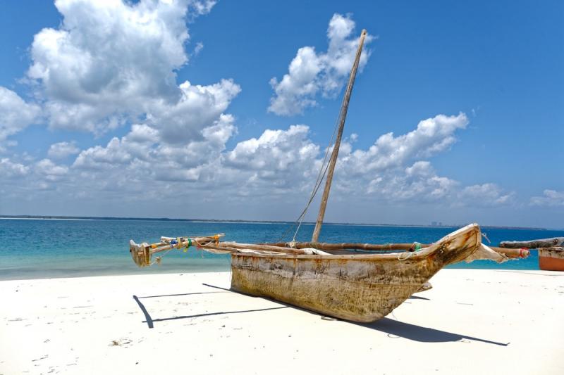
-
Boating
-
Coral Reef
-
Marine Park
-
Snorkeling
Mbudya Island Marine Reserve
Mbudya Island Marine Reserve is also an uninhabited island in the northern part of Dar es Salaam. The island set on the beach resort and fishing community of Kunduchi and is reachable by means of a 20 minute motorboat ride crossing from the mainland. The natural resources of the area are very similar to that of Bongoyo Island Marine Reserve. It hosts ruins of a German outpost and a tomb, thought to be of the descendant of Prophet Muhammad, the founder of Islam. The tombs have generated myths, and pull visitors who visit them to pay homage and make sacrifices for cleansing and fortune.
The island offers fabulous snorkeling and diving opportunities. Mbudya Island is situated about 3 km offshore, within easy reach of the hotels on the North coast of Dar es Salaam. The Island is characterized with sand beaches on the western and eastern sides. On the western side, it is possible to have barbecued fish with chips and drinks. There is plenty of shade under the Casuarina trees; on the beach there are all necessary facilities including bandas where you can rest while enjoying chips with fish and soft drinks provided by Honorary Rangers.
The island is clothed with dense stands of palms and baobabs. The rare coconut crabs (Birgus latro) are found on the island. To get to the island, one of many local motorized dhow and ngalawas can be hired. The hotels located in the area (White Sands, Silver Sands, Kunduchi Beach, Beach Comber are Bahari Beach) provides more modern transport to the island.
ENTRANCE FEE FOR EACH PERSON PER DAY IN THE MARINE RESERVES
| Tanzanians | Non Tanzanians | |
|---|---|---|
| For each person above the age of 16 years | Tshs. 2,360.00 (VAT inclusive) | US$ 11.80 (VAT inclusive) |
| Between the age of 5 years and 16 years | Tshs. 1,180.00 (VAT inclusive) | US$ 5.90 (VAT inclusive) |
| Children below the age of 5 years | Free | Free |
BOAT AND SPORT FISHING LICENSING WITHIN MARINE PARKS ONLY
| Boats powered by engines of 40hp or less (including mashuas) trading in marine resources | US$ 59/month(VAT Inclusive) |
| Boats powered by engines of more than 4hp trading in Marine Resources | US$ 118/month(VAT Inclusive) |
| Visiting leisure boat privately owned and non-commercial | US$ 118 /entry / 5 days (VAT Inclusive) |
| Visiting commercial leisure boat including chattered | US$ 236 /entry / 5 days(VAT Inclusive) |
| Game fishing boat | US$ 236 /entry / 5 days(VAT Inclusive) |
| Cruise ship/tourist passenger boat | US$ 1180 /entry / 5 days(VAT Inclusive) |
| Visitors staying at lodges and fishing in a boat owned by registered Business in the Marine Parks or visiting game fishing boats shall pay a fishing license of | US$ 59/entry / 5 days(VAT Inclusive) |
| Fishermen on game fishing boats each pay a fee of | US$ 59 for period up to 5 days(VAT Inclusive) |
-
Beach
-
Boating
-
Coral Reef
-
Marine Park
-
Snorkeling
.jpg)
Pangani Island Marine Reserve
Pangani Island Marine Reserve is another uninhabited island located in the northern of the country capital city, Dar es Salaam and is one of the seven islands of the Dar es Salaam Marine Reserve System (DMRS). The island is small, only about 250 m long; it has a rocky coastline without beaches. It provides protection for several important biological diversity and tropical habitats; sea grass beds, Coral reefs and different fish species.
Pangavini Island has the splendour of being the nocturnal home of most of the birds that hove over Dar es Salaam city during the day. It is also the nesting sanctuary of the birds. The reserves also save as a stopover of migratory birds during their flight from winter. Pangavini Island is an important breeding, resting and feeding site to a variety of rats, birds and reptiles. The area is unique due to their good scenic diving and snorkeling sites and there are numerous and extensive sea grass beds within the reserve area.
-
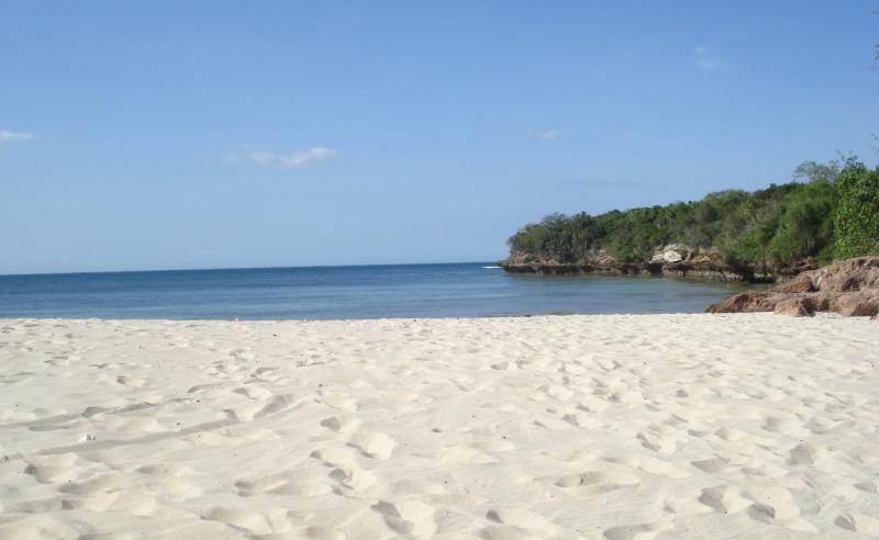
Beach
-
Boating
-
Coral Reef
-
Marine Park
-
Snorkeling
Fungu Yasin Sand Bar
Fungu Yasin Sand Bar
This is unique Marine Reserve which is an island of sand bank seen only during low tide and is devoid of vegetation. It is located in the northern part of Dar es Salaam after Mbudya Island Marine Reserve. The lower intertidal zone on the west and north is sandy with abundant sea grass mixed together with coral patches. The southeast lower intertidal areas are rocky.
Coral reefs are found on the western and eastern side of the Island where more than 35% of coral cover is located on two locations: one on the southwest waters of less than 10 m (108,320 m2) and the other on the deeper waters (462,765 m2).
Like other DMRS islands the dominant sea grass species are Thallasodentron ciliatum and Thalassia hemprichii. Animals in the intertidal flats include sea cucumbers, octopus, sea urchin, giant clamps, rock crabs, tigger cowry, starfish, cushion starts, nudibranchia and crabs.
-
Beach
-
Boating
-
Coral Reef
-
Marine Park
-
Snorkeling
Sinda island Marine Reserve
This reserve is found in the Southern Coast of Dar es Salaam (Kigamboni).Inner and Outer Sinda Islands Marine Reserve was about 288.7 Hectares, Inner and Outer Sinda Islands cover an area of 23.31 and 23.96 Hectares, respectively. Sinda Islands coastlines include rocky cliffs and sandy beaches
In Sinda, the maximum depth is less than 10 m. Seawards of the reserves, the deep water (> 50 m) is just 1.8 km and 3.2 km away from Outer Sinda and Outer Makatumbe Islands, respectively. Proximity to deep waters makes the seawards sides of the reserves prone to high tidal currents and waves, especially during spring tides. The seawards sides of all reserves can be described as high energy areas (ie. high wave impact areas) and are characterised by rock cliffs .
Interesting sandy beaches are found on the north and south of Inner Sinda Island and on landward of Sinda Island . Beaches on the Outer Sinda are located relatively in the middle of intertidal zones, hence are far from beautiful swimming sports. They can however, be useful for resting and other land based tourist activities, daytime lunch facilities.The south Inner Sinda beach has the best morphology for tourism related activities: The beach is larger and adjacent to the beach there is a flat land area large enough to build tourist facilities. Additionally, there is also a large beach on the north of Inner Sinda . The combination of beaches, land vegetation and good coral reefs make this place suitable for combined land-sea eco-tourism.
-
Beach
-
Boating
-
Coral Reef
-
Marine Park
-
Snorkeling
.jpg)
MAKATUBE ISLAND MARINE RESERVE
This reserve is found in the Southern Coast of Dar es Salaam (Kigamboni). It consisting of two islands namely Inner Makatube and Outer Makatube.The area cover of Inner and Outer Makatumbe Islands was estimated to be 10.99 and 9.89 Hectares respectively, Makatumbe coastlines include rocky cliffs and sandy beaches, Interesting sandy beaches are found on the landward sides Inner and outer Makatumbe Islands.
In Makatumbe, coral reefs were found on the north, northeast and west sides. Coral cover was low (< 5 %) on the high energy zone and medium (5 – 35 %) on northeast and west sides. Soft corals and few hard coral species resistant to high energy environments were observed on the high energy zones. Algal mat dominated high energy areas where coral cover was less. High abundance of starfish was noticed northeast of Makatumbe, especially on curves and on protected sides of protruding structures, e.g. coral outcrops. The large sponge, Xestospongia testudinaria, was also common on this zone.
-
Beach
-
Boating
-
Coral Reef
-
Marine Park
-
Snorkeling
Tanga Marine Reserves System
Tanga Marine Reserves System (TMRS) encompasses four island reserves of Kirui, Mwewe, Kwale, and Ulenge which form a unique ecological system lying along and adjacent to a coastline and surrounding waters that comprise of a diverse of coastal and marine habitats ranging from luxuriant fringing corals, sea grass beds and an almost continuous strip of mangrove stands.
Tourism Attractions
- Sea grass beds in sub tidal zone northeast of Kirui Island.
- A sandy beach in East coast of Kirui Island.
- Mangrove (Rhizophora mucronata) on Ulenge (south) Some common invertebrates found in the TMRs include mangrove crabs, prawns, octopus, lobsters, clams, sea cucumbers, and shelled molluscs. A small population of dugong is believed to exist at Mbayae‐Kigomeni area, just east of Kirui Island and south of Kenya border, where it was sighted in 1994 and 2004
- Dugong Coelacanth (Latimeria chalumnae) is found around Tanga Coelacanth Marine Park, which is less than 10 km from Ulenge Island Marine Reserve (below picture). The shallow water area extending from south Kenya coast including eastwards of Kirui Island and Moa Bay could be considered as a special habitat. This zone has a complex combination of mangrove influences, extensive seagrass beds and coral reefs, creating good conditions for fish productivity. Besides being important fishing area for Kenya and Tanzania fishers, it is in this zone where dugongs are believed to exist.
- Rhizophora mucronata mangroves on Kirui west creek
All TMRS constitute important bird roosting sites. Nature trails and bird watching posts could be created as tourist attractions.
As the islands were once inhabited, they have remained with cultural values linked to the adjacent communities such as historical ruins, traditional and spiritual connections as ancestral grave yards and sacred groves. These are potential amenities for community based ecotourism and other recreational promotions.
Mangrove is the main feature in the intertidal zones of all TMRs. In Ulenge, mangrove covers an area of 72.2 Hectares, about 64 % of the Island area. It covers an area of about 528.1 Ha, or 86.2 % of Kwale the Island. Mwewe Island is also surrounded by mangroves, which covers an area of 14 Ha, which is about 68 % of the Island. The total area covered by mangrove in Kirui is estimated to be 680 Ha; the largest mangrove plot (557 Ha) is found on the north and west sides; Kigomeni mangrove (60 Ha) is on the east coast and Kirui south mangrove (63 Ha) is on the south of the Island. All the mangrove species found in Tanzania are found in the TMRs.
-
Beach
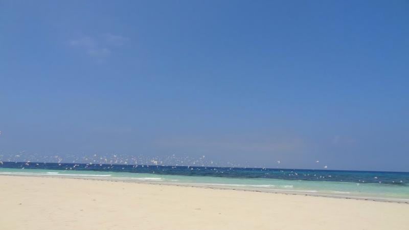
-
Birding Site
-
Boating
-
Coral Reef
-
Marine Park