- Home
- Attractions
- All Attractions
- ATTRACTIONS PROFILES
.jpg)
Kibale National Park
PARK AT A GLANCE
- Size: 795km2
- Kibale is highest at the park’s northern tip, which stands 1,590m above sea level. The lowest point is 1,100m on the floor of the Albertine Rift Valley to the south.
- 351 tree species have been recorded in the park, some rise to over 55m and are over 200 years old.
- Kibale’s varied altitude supports different types of habitat, ranging from wet tropical forest on the Fort Portal plateau to woodland and savanna on the rift valley floor.
- Kibale is one of Africa’s foremost research sites. While many researchers focus on the chimpanzees and other primates found in the park, others are investigating Kibale’s ecosystems, wild pigs and fish species, among other topics.
Kibale National Park contains one of the loveliest and most varied tracts of tropical forest in Uganda. Forest cover, interspersed with patches of grassland and swamp, dominates the northern and central parts of the park on an elevated plateau.
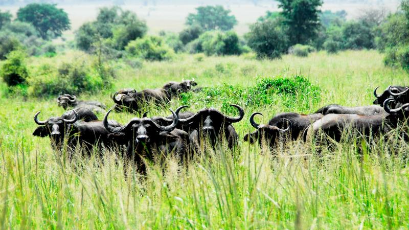
Kibale is famously known for Chimpanzee tracking The park is home to a total of 70 mammal species, most famously 13 species of primate including the chimpanzee. It also contains over 375 species of birds. Kibale adjoins Queen Elizabeth National Park to the south to create a 180km-long corridor for wildlife between Ishasha, the remote southern sector of Queen Elizabeth National Park, and Sebitoli in the north of Kibale National Park.
The Kibale-Fort Portal area is one of Uganda’s most rewarding destinations to explore. The park lies close to the tranquil Ndali-Kasenda crater area and within half a day’s drive of the Queen Elizabeth, Rwenzori Mountains and Semuliki National Parks, as well as the Toro-Semliki Wildlife Reserve.
Areas of interest
Kanyanchu River Camp
Kanyanchu, in the central part of Kibale, is the main trailhead for the park’s famous forest walks, the most popular of which is the daily Primate Walk. There are 13 species of primate to search for, including habituated chimpanzees. Bird watching, nature walks for both kids and adults and guided night treks are also available here.
Sebitoli Forest Camp
Kibale’s secondary tourism centre in the north of the forest offers guided forest walks and a chance to encounter primates such as red colobus, black-and-white colobus, blue monkeys and vervet monkeys. Visitors may also spot a variety of aquatic, forest and savannah birds and enjoy views of the Mpanga River.
Areas of Interest outside the Park
Bigodi Wetland Sanctuary
Rich in biodiversity and beautiful scenery, the wetland is a birder’s paradise with about 138 species. Located outside the park in Magombe Swamp it also hosts eight species of primates including the black-and-white colobus, grey-cheeked mangabey, red-tailed, l’Hoest’s and blue monkeys, and olive baboons. Bushbucks and mongooses can also be found here. The sanctuary was set up to preserve the exclusive environmental features along with the wetland and is managed by the local community.
Kihingami Wetland
Located near Sebitoli in northern Kibale, this community-run project offers excellent bird watching and visits to the local tea estates and factory. Nature walks will bring you up close to primates such as the black-and-white colobus, red colobus and red-tailed monkeys. Other animals like otters, mongooses and bushbucks can be observed in the wetlands.
Wildlife and Birding
Primates
The diversity and density of primates in Kibale is the highest in Africa. The most famous of its 13 species is the chimpanzee, our closest relative. Kibale’s 1450 chimpanzees represent Uganda’s largest population of this endangered primate. The forest is also home to East Africa’s largest population of the threatened red colobus and the rare I’Hoest’s monkey. Other primates include the black-and-white colobus, red-tailed and blue monkeys, grey-cheeked mangabey, olive baboon, bush baby and potto.
Other Wildlife
At least 70 mammal species are present in the park though ground-dwelling animals are difficult to see in dense forest. An estimated 500elephants are present, along with buffalos, leopards, warthogs, bush pigs, golden cats and duikers. A keen observer may spot reptiles and amphibians as well as a colorful variety of 250 species of butterflies.
Birding
The park boasts more than 375 species of birds. Kibale specials include the African Pitta, Green-breasted Pitta, Afep Pigeon, White-naped Pigeon, Crowned Eagle, Red-chested Owlet, Black Bee-eater, Western Nicator, Yellow-rumped Tinkerbird, Little Greenbul, Brown-chested Alethe, Blue-breasted Kingfisher, African Grey Parrot, Scaly-breasted Illadopsis ,Brown Illadopsis, Black-capped Apalis, Blue-headed Sunbird, Collared Apalis, Dusky Crimsonwing, Purple-breasted Sunbird, Red-faced Woodland Warbler, Yellow Spotted Nicator, Little Green Bul, Black-eared Ground Thrush and the Abyssinian Ground-thrush.
-
Forest
-
National Park
-
Wildlife Conservancy
Kidepo Valley National Park
PARK AT A GLANCE
- Size: 1,442km2
- The park’s altitude ranges between 914m and 2,750m above sea level.
- The park contains two rivers – Kidepo and Narus – which disappear in the dry season, leaving just pools for the wildlife.
- The local communities around the park include pastoral Karamojong people, similar to the Maasai of Kenya, and the IK, a hunter-gatherer tribe whose survival is threatened.
- Kidepo Valley National Park lies in the rugged, semi arid valleys between Uganda’s borders with Sudan and Kenya, some 700km from Kampala. Gazetted as a national park in 1962, it has a profusion of big game and hosts over 77 mammal species as well as around 475 bird species.
- Kidepo is Uganda’s most isolated national park, but the few who make the long journey north through the wild frontier region of Karamoja would agree that it is also the most magnificent, for Kidepo ranks among Africa’s finest wildernesses. From Apoka, in the heart of the park, a savannah landscape extends far beyond the gazetted area, towards horizons outlined by distant mountain ranges.
- During the dry season, the only permanent water in the park is found in wetlands and remnant pools in the broad Narus Valley near Apoka. These seasonal oases, combined with the open, savannah terrain, make the Narus Valley the park’s prime game viewing location.
Activities
- Game Drives
- Birding
- Hiking/Nature Walks
- Cultural Encounters
Areas of Interest
Apoka Tourism Centre
Overlooking the game-rich Narus Valley and home to an upmarket lodge and simple UWA-run cottages, Apoka is the park’s tourism hub. Ranger guides are stationed at Apoka to escort tourists on game drives and walks. For those without their own transport, park trucks can be hired. There is a craft shop with books and souvenirs; bottled water, sodas and alcoholic beverages can also be purchased here. Food is cooked on request and cooking gas and utensils can be hired by individuals who wish to cook for themselves.
Narus Valley
Narus Valley is a rolling, grassland plain enclosed by distant mountains. The valley has permanent water, and for much of the year the park’s wildlife congregates here. Thus, the area is well provided with game tracks, with four loop circuits exploring the valley around Apoka. Many creatures such as lions, Jackson’s hartebeest, buffaloes, giraffes, oribis and reedbucks can be seen in the valley. Less commonly seen are cheetahs and leopards. The Narus dam and the water hole near the Tourism Centre are perfect observation points for game, especially during the dry season. At the southern end of the Katurum loop, Katurum kopje (the site of a derelict lodge) is an attractive destination with superb views north across the valley towards the Morungule mountain range.
Kidepo Valley and Kanangorok Hot Springs
For most of the year, a lack of surface water means that little wildlife is found in Kidepo Valley, though it is still worth the drive to visit the dry Kidepo River to stroll along its 50m wide bed of white sand between banks covered with borassus palms. Kidepo means to pick from below and the valley was visited by people coming to gather fallen borassus fruit for fermenting to make palm beer. The Kanangorok Hot Springs lie 11km beyond the Kidepo River on the Sudan border. This is a glorious place to sit and view the mountains beyond the frontier.
Mount Morungule
Mount Morungole stands at 2,750m and is crossed by the Kidepo and Narus Rivers that nourish the park’s wildlife and this natural habitat as a whole. The Morungole Range marks the southern boundary of the park and rises from the plains a few kilometres northeast of Apoka. This region can be explored on foot with a ranger. The mountain slopes are home to the IK people, the smallest ethnic group in Uganda, with their own unique culture.
Namamukweny Valley
Namamukweny is a Napore word meaning a place with no birds or a lonely place with few people – though regarding the birds, quite the opposite is true! The valley is inhabited by a large number of bird species such as the Eastern Paradise Whydah, White-crested Turaco, Common Bulbul, Abyssinian Roller and Green Wood Hoopoe among others. It is located in the north-west of the park and can be accessed by car or on foot.
Lomej Hills
The Lomej Hills are a short drive from the headquarters. They are a good viewing point for birds and wildlife, including the mountain reedbuck.
Beyond Apoka
Lonyili Mountain
Lying between Kitgum and the Sudan border, Lonyili Mountain is largely covered in montane forest and home to primates such as colobus monkeys. Due to poor conditions in this area the road is currently out of use. There are plans to repair it - you are strongly advised to contact UWA for updates before embarking on your journey to the mountain.
-
National Park
.jpg)
Lake Mburo National Park
PARK AT A GLANCE
- Size: 370km2
- Altitude: 1,220m - 1,828m above sea level
- Wetland habitats comprise 20% of the park's surface
- The parks' precarious past has seen wildlife virtually eliminated several times: firstly in various attempts to rid the region of tsetse flies, then to make way for ranches, and finally as a result of subsistence poaching.
- 20% of the park's entrance fee is used to fund local community projects such as building clinics and schools.
- Lake Mburo National Park is a compact gem, located conveniently close to the highway that connects Kampala to the parks of western Uganda. It is the smallest of Uganda’s savannah national parks and underlain by ancient Precambrian metamorphic rocks which date back more than 500 million years. It is home to 350 bird species as well as zebra, impala, eland, buffalo, oribi, Defassa waterbuck, leopard, hippo, hyena, topi and reedbuck.
- Together with 13 other lakes in the area, Lake Mburo forms part of a 50km-long wetland system linked by a swamp. Five of these lakes lie within the park’s borders. Once covered by open savanna, Lake Mburo National Park now contains much woodland as there are no elephants to tame the vegetation. In the western part of the park, the savanna is interspersed with rocky ridges and forested gorges while patches of papyrus swamp and narrow bands of lush riparian woodland line many lakes.
Wildlife and Birding
Wildlife
The park's varied habitats support 68 mammal species. Rarities include impala, which, in Uganda, only lives in Lake Mburo, and Burchell’s zebra and eland which are found only here and in Kidepo.
Other species include warthog, buffalo, oribi, Defassa waterbuck and reedbuck. Leopard and hyena are also present while crocodile and over 300 hippos are found in the lake. Previously extinct in the park, lions have recently been sighted again.
Birds
Around 350 bird species have been recorded to date. These include the Red-faced Barbet, only seen in Lake Mburo, the endemic African Finfoot and the rare Shoebill. Other key species are the Papyrus Yellow Warbler, Saddle-billed Stork, Brown-chested Lapwing, African-wattled Lapwing, Carruther’s Cisticola, Tabora (Long-tailed) Cisticola, African Scops Owl, Abyssinian Ground Hornbill and White-winged Warbler.
Acacia woodland bird species are especially well represented, while forest species may be found in Rubanga forest. These include Blue-breasted Kingfisher, Hairy-breasted Barbet and Yellow-rumped Tinkerbird, among others.
Activities
Birding
Lake Mburo's key birding spots include swampy valleys and viewing platforms near the salt licks and in the forest. Species found at these locations include the Rufous-bellied Heron, Bateleur, Coqui Francolin, Grey Crowned Crane, Black-bellied Bustard and Brown-chested Lapwing.
Trips in Lake Mburo
The wildlife-rich eastern banks of Lake Mburo can be explored during a tranquil two-hour boat voyage. Keep an eye out for crocodiles, buffalo, and hippos as well as colorful Kingfishers, magnificent Fish Eagles and Hammerkops with their enormous nests.
Game Drives
The network of game tracks in the east of the park passes a variety of landscape features including acacia woodland, wetlands, grassy hillsides, rock outcrops and seasonally flooded valley floors.
Hiking and Nature Walks
Unusually, the whole park is open to walkers as long as they are accompanied by a ranger guide. Locations include the salt lick at Rwonyo, the lake's banks, Rubanga Forest and a hilltop with gorgeous lake views.
Sport Fishing
Lake Mburo contains around six species of fish, with tilapia being the most common. The designated fishing spot is at Mazinga.
Horseback safaris
Horseback safaris are an exciting way to view wildlife including eland and buffalo. Also commonly sighted are warthog, topi, impala, duiker, bushbuck, waterbuck and zebra.
Areas of Interest
Rwonyo Rest Camp
Rwonyo is the center for tourism activities in the park. It is the starting point for nature hikes, quad biking, game drives and forest walks. There is also a small shop selling handcrafts and books.
Lake Mburo
Lake Mburo is a natural haven for fauna and flora. The bank teems with animals and birds. Crocodiles and hippopotami are permanent residents, and buffalos come to drink during the dry season. The wide variety of resident birds includes Malachite Kingfishers, Pied Kingfishers, African Fish Eagles, Rufous Long-tailed Starlings, Blue-headed Weavers, Green-necked Doves, Hammerkops, Pelicans, Herons, Cormorants and even rare Shoebills.
Rubanga Forest
Though small, this tract of forest on the western side of Lake Mburo provides a taste of tropical high forest with a closed canopy and a viewing platform for visitors. It is home to a variety of forest birds; commoner species include the Harrier Hawk, Green Pigeon, Narina Trogon, Grey-backed Cameroptera and Double-toothed Barbet. Rubanga can be explored with a ranger guide.
Game Tracks
There are several tracks on the eastern hinterland of the park where a variety of animals and birds can be seen. A hilltop viewpoint offers panoramic vistas of the park and its five lakes.
-
Birding Site
-
Lake or River
-
Lake or River
-
National Park
.jpg)
Mgahinga Gorilla National Park
PARK AT A GLANCE
- Size: 33.7km2, making it Uganda’s smallest National Park.
- The park takes its name from "Gahinga" - the local word for the piles of volcanic stones cleared from farmland at the foot of the volcanoes.
- The British administration declared the area a game sanctuary in 1930; it was gazetted as a National Park in 1991.
- Mgahinga has one habituated trans-boundary gorilla group.
- The Batwa were self-sufficient – and visitors can see how during a fascinating tour with a Batwa guide to learn the secrets of the forest.
- Mgahinga Gorilla National Park sits high in the clouds, at an altitude of between 2,227m and 4,127m. As its name suggests, it was created to protect the rare mountain gorillas that inhabit its dense forests, and it is also an important habitat for the endangered golden monkey.
- As well as being important for wildlife, the park also has a huge cultural significance, in particular for the indigenous Batwa pygmies. This tribe of hunter-gatherers was the forest’s “first people”, and their ancient knowledge of its secrets remains unrivalled.
- Mgahinga’s most striking features are its three conical, extinct volcanoes, part of the spectacular Virunga Range that lies along the border region of Uganda, Congo and Rwanda. Mgahinga forms part of the much larger Virunga Conservation Area which includes adjacent parks in these countries. The volcanoes’ slopes contain various ecosystems and are biologically diverse, and their peaks provide a striking backdrop to this gorgeous scenery.
Areas of Interest
The Virunga Volcanoes
The Virungas are a chain of eight volcanoes which dot the borders of Uganda, the Democratic Republic of the Congo and Rwanda. Three of the conical peaks are in Uganda’s Mgahinga Gorilla National Park:
Muhavura (4,127m) is the highest of the peaks in Mgahinga Gorilla National Park. The name means guide, and the Batwa used to look for its high peak to help orient themselves in the forest. Muhavura has a crystal clear crater lake about 36m wide at its summit. The top commands panoramic views far into Uganda, Rwanda and along the length of the Virunga chain
Mount Gahinga (3,474m) is the smallest of the Virunga volcanoes. It is named after the local practice of tidying the volcanic debris that clutters local farmland into neat cairns – or gahinga. Its swamp-filled crater is around 180m wide.
Sabinyo means old man’s teeth, a reference to its jagged summit which is dissected by deep gorges and ravines. The countries that share the Virungas – Uganda, Rwanda and the DR Congo – meet on the highest of Sabinyo’s stumpy peaks.
Caves
Some of the steep mountain slopes contain caves formed by lava tubes, one of them being the famous Garama Cave located near the park headquarters. This is a sacred place for the Batwa, and during the Batwa Trail you can discover how it was used as a shelter during battles and as a place to store looted treasures.
Ntebeko Visitors’ Centre
The Visitor Centre at Ntebeko is the starting point for nature walks, volcanoes hiking, golden monkey and gorilla tracking and the short (4km) Batwa Trail. The trailhead of the long Batwa trail is at the base of Mt Muhavura. Exhibits inside the building explore themes relating the Virunga environment. A trail along the stone Buffalo Wall – built to keep animals out of neighboring farmland – provides good birding and views of the volcanoes.
Outside the Park
Lake Bunyonyi
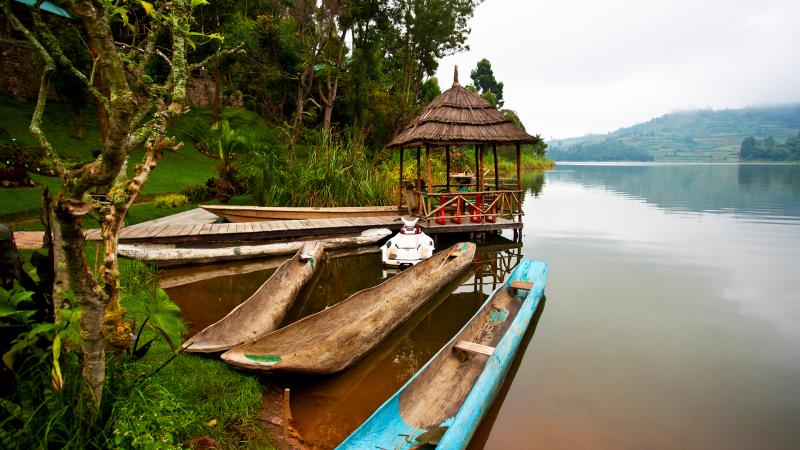
A worthwhile diversion on the route to Mgahinga from Kabale, Lake Bunyonyi is dotted with at least 20 small islands and encircled by steep terraced hills, Africa’s second deepest lake is unforgettably scenic. Visitors can stay overnight at a number of lakeside resorts or simply follow the lakeshore road to Kisoro and Mgahinga.
Wildlife and Birding
Gorillas
Mgahinga is home to the habituated Nyakagezi gorilla group - a fairly nomadic bunch that have been known to cross the border into Rwanda and the Congo. The family includes the lead silverback Bugingo who is around 50 years old and father to most of the group; his silverback sons, Mark and Marfia; and two blackbacks, Rukundo and Ndungutse, who love to pose and play in the trees. The two females, Nshuti and Nyiramwiza, both have babies Furraha and Nkanda respectively.
Birds
The varied habitats of Uganda’s smallest park make it home to a variety of birds with 179-184 species recorded. The list includes the Ibis, Pin-tailed Whydah, Speckled Mousebird, Stone Chat, Grey-capped Warbler, Wax Bills, Yellow-vented Bulbul, Firefinch, White-naped Raven, Black Kite, Rwenzori Turaco, Blue-headed Coucal, Paradise Fly-catcher, Rwenzori Batis, Double-collared Sunbird, Rwenzori Nightjar.
Golden Monkeys
The endangered golden monkey is endemic to the Albertine Rift, and Mgahinga Gorilla National Park offers a rare chance to track these striking creatures, high in the dense bamboo forests on the Gahinga trail. There is an estimated 3000-4000 individuals in the Virunga area which 42-60 are habituated in Mgahinga.
Other Wildlife
Mgahinga is home to 76 species of mammals, although they are difficult to glimpse in the wild forest vegetation. They include giant forest hogs, bush pigs, forest buffaloes, elephants, bushbucks, golden cats, side striped jackals, black fronted duikers and South African porcupines.
Activities
- Gorilla Tracking
- Mountain/Volcano
- Mountain/Volcano Climbing : All three volcanoes in this park can be summited, taking a full day each. Views from the peaks are well worth the effort - taking in Rwanda, DR Congo, the Virungas, the Rwenzoris, Bwindi Impenetrable Forest and Lake Edward.
- Cultural Encounters
- The Batwa Trail
- Birding : The best birding in Mgahinga also takes in some of its most beautiful scenery - in the gorge between Mts Gahinga and Sabinyo, through the bamboo forest, and in the montane forest, where the beautiful Rwenzori Turaco may be observed.
- Hiking and Nature Walks :Hiking around the foothills of the Virunga Volcanoes gives visitors the chance to spot forest birds, the Rugezi Swamp, wild vegetation, bamboo forests and glorious views of the surrounding lakes and agricultural villages.
-
Forest
-
Mountain
-
National Park
-
Volcano
.jpg)
Mount Elgon National Park
PARK AT A GLANCE
- Size: 1,121km²
- This extinct volcano is one of Uganda's oldest physical features, first erupting around 24 million years ago.
- Mt Elgon was once Africa's highest mountain, far exceeding Kilimanjaro’s current 5,895m. Millennia of erosion have reduced its height to 4,321m, relegating it to the 4th highest peak in East Africa and 8th on the continent.
- Mt Elgon is home to two tribes, the Bagisu and the Sabiny, with the marginalized Ndorobos forced to dwell deep within the forest of Benet.
- The Bagisu, also known as the BaMasaba, consider Mount Elgon to be the embodiment of their founding father Masaba and refer to the mountain by this name.
- At 4,000km² Mt. Elgon has the largest volcanic base in the world. Located on the Uganda-Kenya border it is also the oldest and largest solitary, volcanic mountain in East Africa. Its vast form, 80km in diameter, rises more than 3,000m above the surrounding plains. The mountain’s cool heights offer respite from the hot plains below, with the higher altitudes providing a refuge for flora and fauna.
- Mount Elgon National Park is home to over 300 species of birds, including the endangered Lammergeyer. The higher slopes are protected by national parks in Uganda and Kenya, creating an extensive trans-boundary conservation area which has been declared a UNESCO Man & Biosphere Reserve.
- A climb on Mt. Elgon’s deserted moorlands unveils a magnificent and uncluttered wilderness without the summit-oriented approach common to many mountains: the ultimate goal on reaching the top of Mt. Elgon is not the final ascent to the 4321m Wagagai Peak, but the descent into the vast 40km² caldera.
Areas of Interest
Forest Exploration Centre
The Forest Exploration Centre at Kapkwai, 13km from Sipi town, doubles as an educational centre for schools and the trailhead for climbers using the Sipi trail to the caldera. Three circuits of between 3-7km run through the surrounding regenerating forest, where visitors canvisit caves, waterfalls, escarpments and viewpoints; and observe birds and primates. Bird species encountered here include Hartlaub's Turaco, Eastern Bronze-napped Pigeon, Lemon Dove, Dusky-Turtle Dove, African Hill Babbler, Alpine Chat, Black-throated Wattle-eye, Mountain Yellow Warbler, Thick-billed Honey guide, Grey Cuckoo-Shrike.
Accommodation is available for student groups.
Caves
Mount Elgon’s slopes are riddled with caves left by moving lava and erosion of soft volcanic deposits. The most accessible are Kapkwai Cave, near the Forest Exploration Centre, and Khauka Cave on Wanale Ridge. Historically, such features acted as shelters for locals and their livestock; later on they provided manure in the form of bat droppings. More recently, they were used by climbers and their porters, and even today, campsites are still located at Hunters Cave, Siyo Cave (near the hot springs), Mude Cave and Tutum Cave – ideal for overnight expeditions.
Jackson’s Pool and Jackson’s Peak
Jackson’s Pool stands at 4,050m and is a natural pool with shallow waters. This pool lies in the shadow of the 4,165m high Jackson’s Peak, a free-standing volcanic plug rising from the western flank of the mountain. These features were named after the explorer Frederick Jackson, who in 1889 was the first European to climb Mount Elgon. The peak is used by the locals as a spot to communicate with their ancestors.
The peaks and the caldera
Mount Elgon’s highest peaks are formed by high points around a jagged rim enclosing one of the world's largest calderas, at 40km long and 8km wide. The tallest peak is the 4,321m Wagagi, followed by Sudek (4,303m), Koitobos (4,222m) and Mubiyi (4,210m).
The Caldera was formed as a result of magma being drained from the chamber. When it could no longer support the overlying volcanic cone, it collapsed into a depression-like shape. In the eastern corner of the caldera, hot springs are found at the start of the deep Suam Gorge. In the northwest, Simu Gorge was formed by the sheer weight of the water in the caldera cutting two stream beds out of the weak volcanic ash and agglomerate walls.
Vegetation
Mt. Elgon’s vegetation is banded into broad zones whose characteristics are dictated by altitude and rainfall. The lower mountain slopes are covered with dense forest and regenerating forests, hung with vine-like lianas, epiphytes and lichens. The floor is covered with a carpet of ferns, orchids and flowering plants. Common tree species encountered in the tropical montane forest (1,500-2,500m asl) are olive Oleahochstetteri, prunus africanas, Elgon teak, podocarpus, cedar, Cordia, Neoboutania, allophyllus tombea and Aningueriaadolfi-friedericii.
The zone changes to mixed bamboo at 2,500-3,000m. The bamboo merges into open woodland dominated by hagenia abyssinica and African rosewood interspersed with hypericum – a giant form of St. John’s wort.
The heath zone (3,000-,3500m) is characterized by giant heather interspersed with grassy swards of blonde tussock grass dotted with pink and white everlasting flowers (ericriceum brownie and jonstonii) , flame-colored gladioli, blue delphiniums and red hot pokers.
The moorland or Afro-alpine zone (3,500-4,321m) contains senecio elgonensis, Erica tree, giant lobelias with hairy leaves and plumes of tiny blue flowers, ladies’ mantle tussocks (archimilla elgonesis) and pink and white everlasting flowers.
The summit of the mountain is vegetated by rare Afro-montane species that include giant forms of lobelia and groundsel.
Nkokenjeru Ridge and Wanale
Nkokenjeru Ridge is a distinctive finger of forest extending outwards from the main massif of Mount Elgon. It lies at an elevation of 2,347m and covers a 25km-long tongue of lava that flowed out of the side of the volcano after the cone collapsed to block the main vent. Nkokenjeru Ridge culminates at the superb Wanale Cliffs which tower above Mbale Town; the seasonal Nabuyonga and Namatyo Waterfalls are located here. A trail at this western end of the ridge leads you to Khauka Cave where petrified wood can be found.
This ridge also offers grounds for those interested in paragliding over the Mbale town.
The Nabuyonga Trail is a 5km loop with birding, fauna and flora. Viewpoints overlook Mbale town, Lakes Kyoga, Bisina and Salisbara, and the rugged mountains in Karamoja region. On a clear day, you may enjoy vistas of Wagagai peak and even areas of western Kenya. Beware of throwing a stone into the Nabuyonga stream – local folklore claims that if you do so, a thunderstorm will strike before you leave!
Beyond the park
Sipi Falls
The northern and western sides of Mount Elgon rise in a series of massive basalt cliffs, often several kilometres in length, over which the mountain’s rivers plunge as beautiful waterfalls. The best known are the three waterfalls at Sipi on the Kapchorwa road, just outside the park. The lowest of these falls is the most spectacular as it cascades over a 100m cliff. The second, known as Simba, plunges 69m over the entrance to a cave. Visitors can stand in the cave and enjoy a view of the back of the falls. The third waterfall, also known as Ngasire, gushes over an 87m high ridge. Sipi Falls is less than an hour’s drive from Mbale on a paved road.
Easily accessible waterfalls are also found at Sisiyi, Bulago, Chebonet and Wanale and many more are scattered across the mountain, offering spectacular views.
Tewei Hill
Outside the park overlooking Sipi Falls is the hill where, during the 1960s, Chemonges Kingo, King of the Sabiny would meet his subjects. From the top you can view the three falls, the Karamajong plains and the Wagagai peak.
Pian Upe Wildlife Reserve and Matheniko Bokora Wildlife Reserve
In the plains of Karamoja to the north of Mount Elgon lie Matheniko Bokora Wildlife Reserve and the expansive Pian Upe Wildlife Reserve, the second largest protected area in Uganda, with an area of 2,788km2. Wildlife found here includes rare species such as the roan antelope, lesser kudu, Bright’s gazelle and ostriches which, in Uganda, are found only here and in Kidepo Valley National Park. Wildlife is concentrated around the Loporokocho swamp; bird species encountered here include Hartlaub's Turaco, Eastern Bronze-napped Pigeon, Lemon Dove, Dusky Turtle Dove, African Hill Babbler, Alpine Chat, Black-throated Wattle-eye, Mountain Yellow Warbler, Thick-billed Honey guide and Grey Cuckoo-Shrike.
Rock paintings found at various sites within the Matheniko Bokora Wildlife Reserve are believed to date back over 3000 years and were created by the Kushite and Nilotic peoples.
Nyero Rock Paintings
65km north of Mbale, the Nyero Rock Paintings are the finest of several rock art sites in the region. Three panels are found within the extensive granite outcrop of Moru Ikara, 10km from Kumi Town and 55km from Mbale on the Soroti road. The most impressive is Panel Two which includes two canoes bearing human figures.
Scenic viewpoints outside the park
A detour to Bulago off the Mbale-Sipi road reveals a village standing high above a waterfall facing the Simu Valley towards Butandiga ridge. The route to Kapchorwa beyond Sipi Falls to the north provides a stunning view towards Mount Kadam and the vast plains of Karamoja. The top of the Sironko Valley in Budadiri, enclosed by the Mudangi Cliffs and the Nkonkonjeru Ridge, provides a picturesque view of the montane forest and caldera peaks. Visitors should also drive to the top of Wanale Cliff for panoramic views over the town of Mbale.
Wildlife and Birding
Wildlife
The Park supports a variety of wildlife including rock and tree hyraxes, elephant, buffalo, Defassa waterbuck, oribi, bushbuck, duiker, forest hog, bush pig, leopard, civet and serval cats, serval cats, spotted hyena; aardvark and several rodent species. However these animals are rarely observed in the forest setting. More commonly seen creatures are the black-and-white colobus; baboons; red tailed, vervet, De Brazza’s and blue monkeys; duiker and tree squirrel.
Birds
The mountain is home to 300 birds including 40 restricted range species. 56 of the 87 Afrotropical highland biome species live here, notably the Moorland Francolin, Moustached Green Tinkerbird and Alpine Chat.
Birds whose Ugandan range is limited to Mount Elgon include the Jackson's Francolin and Black-collared Apalis. Among those limited to just a few mountains in eastern Uganda are the Black-shouldered Kite and Tacazze Sunbird. Mount Elgon is one of the few places in Uganda where the endangered Lammergeyer can be seen, soaring above the caldera and Suam Gorge.
Activities
- Birding.
- Nature walks.
- Sport fishing.
- Hiking/Nature.
- Cultural Encounters.
- Mountain Biking.
- Rock climbing.
-
Birding Site
-
Forest
-
Mountain
-
Mountain Climbing
-
National Park
Murchison Falls National Park
PARK AT A GLANCE
- Size: 3,840km2
- Murchison Falls became one of Uganda’s first national parks in 1952
- At Murchison Falls, the Nile squeezes through an 8m wide gorge and plunges with a thunderous roar into the "Devil's Cauldron", creating a trademark rainbow
- The northern section of the park contains savanna and borassus palms, acacia trees and riverine woodland. The south is dominated by woodland and forest patches
- The 1951 film "The African Queen" starring Humphrey Bogart was filmed on Lake Albert and the Nile in Murchison Falls National Park
- Murchison Falls National Park lies at the northern end of the Albertine Rift Valley, where the sweeping Bunyoro escarpment tumbles into vast, palm-dotted savanna. First gazetted as a game reserve in 1926, it is Uganda's largest and oldest conservation area, hosting 76 species of mammals and 451 birds.
- The park is bisected by the Victoria Nile, which plunges 45m over the remnant rift valley wall, creating the dramatic Murchison Falls, the centerpiece of the park and the final event in an 80km stretch of rapids. The mighty cascade drains the last of the river's energy, transforming it into a broad, placid stream that flows quietly across the rift valley floor into Lake Albert. This stretch of river provides one of Uganda's most remarkable wildlife spectacles. Regular visitors to the riverbanks include elephants, giraffes and buffaloes; while hippos, Nile crocodiles and aquatic birds are permanent residents.
- Notable visitors to the park include Winston Churchill, Theodore Roosevelt, Ernest Hemingway and several British royals.
Areas of Interest within the Park
Murchison Falls
Murchison Falls is characterized by eternal war between rock and water. The waters violently compress through a narrow gorge, spraying misty droplets along their wake over a 50m radius. This creates a permanent rainbow over the battlefield and causes a continuous roar. From Baker Point on the southern side, you can also view the Nile splitting into the smaller Uhuru Falls, created in 1962 when the river burst its banks.
River Nile
A boat ride along the Nile to the foot of Murchison Falls is a rewarding experience for nature lovers, as the northern bank teems with a variety of mammals, birds and reptiles. Guided nature walks along both the north and south banks are another refreshing activity, and sport fishing is also possible here. Rafting will be available starting in 2012.
Nile-Lake Albert Delta
This wide, calm stretch of water, where the tranquil Victoria Nile flows into Lake Albert, is a key area for bird watchers. Its papyrus-lined banks are bursting with birdlife, including Goliath Herons, Great Egrets, and African Fish Eagles. The most sought-after species here is the rare Shoebill.
Buligi Game Tracks
\The Buligi game tracks, stretching between the Victoria and Albert Niles, are the Murchison Falls National Park’s most popular safari destination. At around 120-170km in length, they pass through open savannah grassland, woodland, acacia and riverine vegetation. Most of the park’s game can be viewed here, especially during early morning and early evening tours.
Paraa
Paraa, meaning home of the hippo in the local Luo language, is the park’s tourism hub. All the park’s access roads converge here as the northern and southern banks are linked by a passenger ferry, and several accommodations are located nearby. Additionally, a museum and gift shop can be found on the north bank, and most game drives, launch trips and nature walks commence here.
Karuma Falls
The Karuma Falls are located in Chobe, in the northeastern sector of the park. These roaring waterfalls on the Victoria Nile are made up of a series of natural rock formations which cause the waters to ripple and give them a white, foamy appearance. It is an ideal area for sport fishing.
Kaniyo Pabidi Forest
In the south of Murchison Falls Conservation Area, this forest ecosystem contains black-and-white colobus and blue monkeys, olive baboons, and a habituated chimp group which can be tracked. Elephants, buffalos, lions and leopards are also frequent visitors. Many forest birds can be viewed here, including the chocolate-backed kingfisher, white-thighed hornbill and Puvel's illadopsis which is found nowhere else in East Africa.
Kaniyo Pabidi has a campsite, cottage accommodation, forest walks and excellent bird watching.
Rabongo Forest
Surrounded by savanna and covering just 4km2, Rabongo Forest is considered a birders’ paradise because of the endangered species found here. Rabongo is ideal for educational tours as it provides opportunities to identify animals, birds, medicinal plants and trees. For relaxation, visitors can camp and enjoy picnics by the Wairingo River.
Wildlife and Birding
Big Game
The park is home to 76 species of mammals including four of the “Big Five”, with huge herds of buffaloes and elephants, well-camouflaged leopards and a healthy population of lions. It is also known for its giraffes; in Uganda these can only be viewed here and in Kidepo Valley. Other species viewed regularly along the game tracks include Jackson’s hartebeest, bushbucks, Uganda kob, waterbucks and warthogs. Resident crocodiles and hippos as well as other, visiting wildlife are found along the river.
Primates
Olive baboons are common along the roadsides – be sure to keep car windows and doors shut if you don’t want to lose your lunch! Blue and red-tailed monkeys and black-and-white colobus can be found in the forested sectors. The savanna-dwelling patas monkey is only found here and in Kidepo Valley National Park. Around 800 chimpanzees live in the Kaniyo Pabidi and Budongo Forests.
Birds
The varied habitats of Uganda’s largest park make it home to a variety of birds with 451 species recorded. The list includes the Shoebill Stork, the Goliath Heron – the largest heron in the world – and pairs of elegant Grey Crowned Cranes - Uganda’s national bird. Also seen along the banks of the Nile are the Blue-headed Coucal, Swamp Flycatcher, Squacco Heron, African Jacana, Sandpipers, Denham’s Bustard, Abyssinian Ground-Hornbill, Black-billed Barbet, Black-headed Gonolek, Eastern Grey Plantain-eater, Piapiac, Silverbird, Weaver Birds, Pied, Giant and Malachite Kingfishers, Red-throated Bee-eater, White-browed Sparrow Weaver, Speckle-fronted Weaver and African Quail-Finch.
Activities
- Launch Trips
- Game Drives
- Hiking and Nature Walks
- Birding
- Cultural Encounters
- Sport Fishing
- Hot air balloons
-
Birding Site
-
Forest
-
National Park
-
Waterfalls
-
Wildlife Conservancy
Lake Bunyonyi
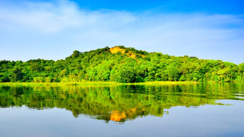
Lake Bunyony is in south-western Uganda between Kisoro and Kabale,and it is close to the border with Rwanda.The lake appears on the 5,000 Ugandan shilling note under the title "Lake Bunyonyi and terraces". Towns on its shores include Kyevu and Muko, while its 29 islands include Punishment Island and Bushara Island.Lake Bunyony is believed to be the second deepest lake in Africa, Lake Bunyonyi is a body of water in southwestern Uganda near the Rwandan border, and one of the country's top natural treasures.
-
Lake or River
-
Lake or River
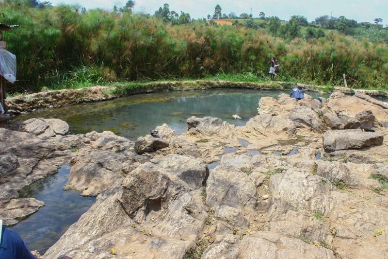
Kitagata Hot Springs
Kitagata Hot Springs are natural hot springs in the Western Region of Uganda. The springs are believed to have natural healing powers
The hot springs are located on the Ishaka–Kagamba Road, in Sheema County, in Sheema District, Western Uganda. This location is approximately 2 kilometres (1.2 mi), by road, southeast of the town of Kitagata, one of the urban centers in the district. This location lies approximately 62 kilometres (39 mi), by road, west of Mbarara, the largest city in the sub-region.
Overview
There are two hot springs adjacent to each other. According to the locals, one of the springs was used by the former Omugabe (King of Ankole) and is known as Ekyomugabe. The other spring is believed to have healing powers and is known as Mulago, after Uganda's largest National Referral Hospital.[4] Some locals drink the water.
On arrival to the site one will notice semi-nude men and women bathing in the warm waters of Kitagata Mulago, the one believed to possess healing powers. Many people bathe in the waters of Kitagata Mulago, sometimes as many as 200 in a twenty-four-hour period. The water in the springs can warm up to 80 °C (176 °F).
The road to this place is marrum and is located near a large swamp. The scenery to the site is breath taking with conical hills and inselbergs characterized with beautiful green vegetation of trees and grass. During the rainy season, River Ngaromwenda, the river that supplies water to the springs floods thereby causing the kitagata springs to be rather warm other than hot.
-
Lake or River
-
Lake or River
-
Natural Springs
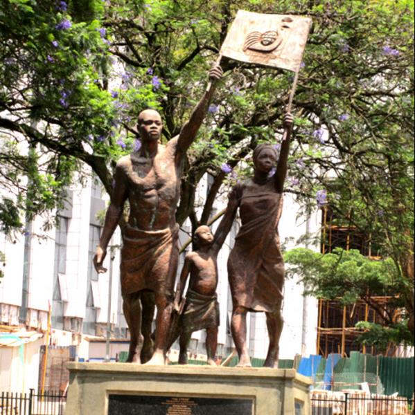
The Stride Monument
Description:
Situated between the Uganda Parliament Gardens and Kampala Serena Hotel, the Stride Monument, was built in commemoration of Uganda hosting the Commonwealth Heads of Government Meeting (CHOGM) in 2007 and was unveiled by the Queen of England during the CHOGM summit. The Stride Monument is estimated to be the most expensive monument in Uganda with the work of its construction costing the country over Ush150 million. This a good sight to visit during your city walks
-
Cultural Centre
-
Cultural Museum
-
Historical Museum
Kabaka's Palace and Office
This interesting attraction consists of two large palaces,(Kabaka’s residence and the Buganda Parliament) connected by a straight road measuring exactly a mile.
When walking from Bulange - home to Mengo office, pay attention to the round-about - the straight road in the middle is for Kabaka's use only, as the local superstition says he must not turn a corner on this route.Half-way from the round-about towards Mengo, you will find a large garden on the right-hand side.Learn the history of Buganda Kingdom and you walk for a mile from the office of the kingdom to the royal palace where you will explore more attractions like, the Iddi Amin Torture chamber
-
Cultural Centre
-
Cultural Museum
-
Historical Museum
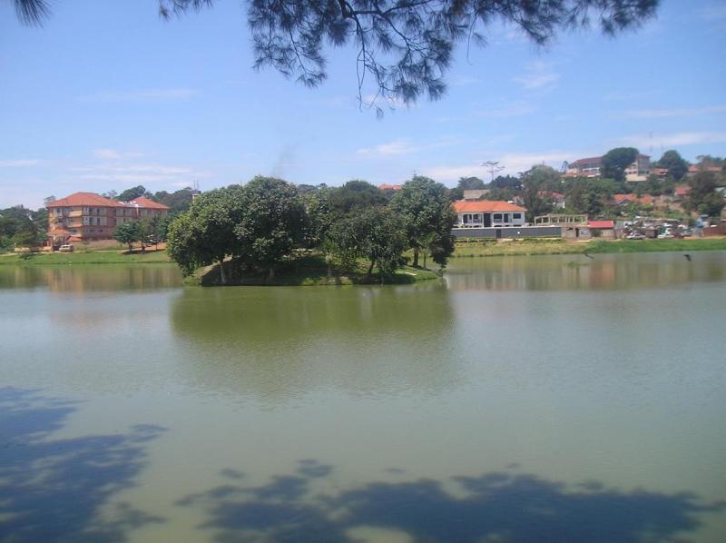
Kabaka's Lake
This is the largest man-made lake in Uganda located in Ndeeba, Rubaga Division Kampala City, Uganda. It is between Ring Road and Nabunya Road. The lake is a few minutes drive from Bulange and about 5 km from the Kampala City centre. It is adjacent to Pope Paul Community Centre in Rubaga. The lake occupies an area of around 2 square km and is about 200 feet deep on an average.
Purpose of the lake
It was constructed by the 52 clans of Buganda from 1885 -1888 during the reign of Ssekabaka Mwanga 11. The plan of the king was to construct a channel wide enough for him to travel by boat to Lake Victoria for swimming and fishing and staying at another palace he had built at Mulungu hill near Lake Victoria The channel would also serve as an escape waterway in the event of armed conflict with the British. The construction was, however, abruptly disrupted and stopped on 2nd August 1888 before the channel could reach Munypnyo because of thea religious war which broke out in the kingdom. .
Inflow and outflow of water
The lake has no visible rivers either to bring in or take out water and yet the water levels of the lake remain almost constant throughout the year.
Environment
The environment around the lake is beautiful. The two small islands in the middle of the lake make it more beautiful .The visitors can walk around the shores of the lake.
-
Lake or River
-
Lake or River
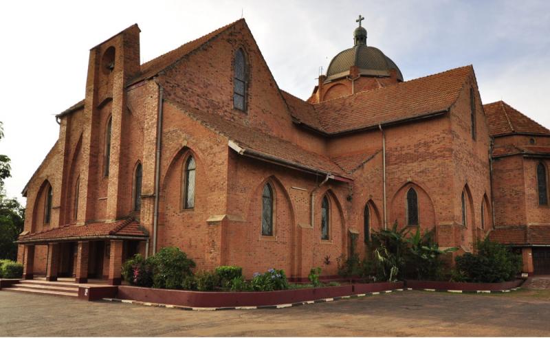
Namirembe Cathedral
The cathedral is located on Namirembe Hill, in Lubaga Division, in Kampala, the capital and largest city in Uganda. Namirembe is located approximately 2 kilometres (1.2 mi), by road, west of Kampala's central business district.
Overview
Namirembe Hill has been the location of the main Anglican place of worship in Buganda since Bishop Alfred Tucker established the offices of the Diocese of Eastern Equatorial Africa in 1890. Tragedy befell the first four church structures:
- The first church building, constructed in 1890, with a capacity of 800 people, was abandoned in 1891 because it was located in a swampy area at the base of Namirembe Hill. Also, a bigger building was needed to accommodate the ever-growing congregation.
- The second church building was constructed between July 1891 and July 1892, with a seating capacity of more than 3,000. In October 1894, strong winds during a thunderstorm blew the roof off the church and it was ruined. Former church building, probably the fourth church (1904-1910)
- The third church building was built between 1894 and 1895. It had a seating capacity of about 4,000 worshippers. That building, constructed with traditional African materials, was abandoned in the early 1900s due to fear that termites would destroy it.
- The fourth church building was constructed with earthen brick walls and a thatched roof, between 1900 and 1904. At the opening ceremony, on Tuesday 21 June 1904, an estimated 10,000 people were in attendance. The congregation included Kabaka Daudi Chwa II, then aged seven years. On the afternoon of Friday 23 September 1910, the roof was gutted by a fire which started when lightning struck the building. Within less than thirty minutes, the entire roof was destroyed and the church was ruined.
The current St. Paul's Cathedral was constructed between 1915 and 1919 using earthen bricks and earthen roof tiles. The cathedral is still standing, but needs repairs from time to time.
-
Cultural Centre
-
Cultural Museum
-
Temple